Property Record
860 Chesapeake St Se, Washington, DC 20032
NEARBY LISTINGS FOR SALE OR LEASE
Property Detail
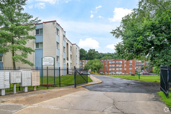
860 Chesapeake St Se
Washington-Arlington-Alexandria, DC-VA-MD-WV
Congress Heights
6210-0039
SQUARE 6210 LOT 0839 NBHD: CONGRESS HEIGHTS
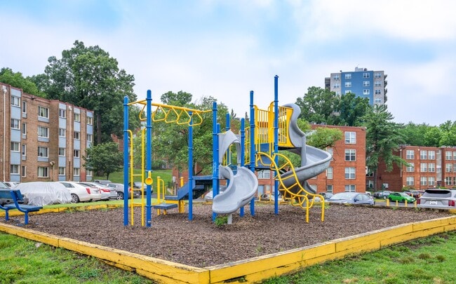
Apartment
District of Columbia
X
District of Columbia
24033C0230E
839
2025
2.60 AC
2025
Congress Heights
009811
Washington, DC
116,707 SF
DEMOGRAPHICS near 860 Chesapeake St Se
1 Mile
3 Mile
5 Mile
2024 Total Population
37,809
149,205
447,442
2029 Population
35,363
141,159
426,619
Pop Growth 2024-2029
(6.47%)
(5.39%)
(4.65%)
Average Age
36
38
39
2024 Total Households
15,262
60,650
202,466
HH Growth 2024-2029
(7.14%)
(5.67%)
(4.92%)
Median Household Inc
$47,163
$57,007
$90,615
Avg Household Size
2.40
2.40
2.10
2024 Avg HH Vehicles
1.00
1.00
1.00
Median Home Value
$328,117
$343,837
$464,546
Median Year Built
1967
1967
1969
Nearby Places
Map Layers
Map Styles
 Street
 Aerial
- Restaurants
- Banks
- Shops
- Fitness
- Groceries
PUBLIC TRANSPORTATION
COMMUTER RAIL
Alexandria (Fredericksburg Line - Virginia Railway Express, Manassas Line - Virginia Railway Express)
DRIVE
WALK
Distance
Alexandria (Fredericksburg Line - Virginia Railway Express, Manassas Line - Virginia Railway Express)
14 min
7.4 mi
Crystal City (Fredericksburg Line - Virginia Railway Express, Manassas Line - Virginia Railway Express)
DRIVE
WALK
Distance
Crystal City (Fredericksburg Line - Virginia Railway Express, Manassas Line - Virginia Railway Express)
17 min
9.2 mi
AIRPORT
Ronald Reagan Washington Ntl
DRIVE
WALK
Distance
Ronald Reagan Washington Ntl
20 min
10.6 mi
Baltimore/Washington International Thurgood Marshall
DRIVE
WALK
Distance
Baltimore/Washington International Thurgood Marshall
53 min
34.7 mi
Washington Dulles International
DRIVE
WALK
Distance
Washington Dulles International
57 min
35.0 mi
Freight Ports
Port of Baltimore
DRIVE
WALK
Distance
Port of Baltimore
63 min
41.3 mi
Nearby Properties
Address
Land Use
TOTAL SIZE
Lot Size
Zoning
Address
Land Use
TOTAL SIZE
Lot Size
Zoning
1,241,298 SF
11.53 AC
RTOLE
Address
Land Use
TOTAL SIZE
Lot Size
Zoning
1,719,751 SF
39.48 AC
PDR-3;UNZO
Address
Land Use
TOTAL SIZE
Lot Size
Zoning
437,938 SF
11.28 AC
CG-4
Address
Land Use
TOTAL SIZE
Lot Size
Zoning
4,000,000 SF
352.96 AC
UNZONED
Address
Land Use
TOTAL SIZE
Lot Size
Zoning
3,231,903 SF
173.70 AC
UNZONED
Address
Land Use
TOTAL SIZE
Lot Size
Zoning
1,931,127 SF
11.53 AC
RTOLE
Address
Land Use
TOTAL SIZE
Lot Size
Zoning
450,000 SF
37.35 AC
UNZONED
Address
Land Use
TOTAL SIZE
Lot Size
Zoning
30,000 SF
819.17 AC
PDR-1;RA-1
Address
Land Use
TOTAL SIZE
Lot Size
Zoning
356,000 SF
16.42 AC
RA-1;RF-1
Address
Land Use
TOTAL SIZE
Lot Size
Zoning
481,325 SF
2.55 AC
CG-5
Address
Land Use
TOTAL SIZE
Lot Size
Zoning
609,265 SF
2.65 AC
CG-5;UNZON
Address
Land Use
TOTAL SIZE
Lot Size
Zoning
300,445 SF
0.86 AC
CG-4
Address
Land Use
TOTAL SIZE
Lot Size
Zoning
250,000 SF
1.11 AC
CG-5;UNZON
Address
Land Use
TOTAL SIZE
Lot Size
Zoning
1,000,000 SF
84 AC
UNZONED
Address
Land Use
TOTAL SIZE
Lot Size
Zoning
373,996 SF
37.74 AC
IE
Address
Land Use
TOTAL SIZE
Lot Size
Zoning
97,230 SF
9.13 AC
CG-4;CG-5
Address
Land Use
TOTAL SIZE
Lot Size
Zoning
234,260 SF
1.39 AC
MU-4
Address
Land Use
TOTAL SIZE
Lot Size
Zoning
1,200,000 SF
28.25 AC
UNZONED
Address
Land Use
TOTAL SIZE
Lot Size
Zoning
900,000 SF
21.18 AC
UNZONED
Address
Land Use
TOTAL SIZE
Lot Size
Zoning
274,244 SF
6.24 AC
RA-1
Address
Land Use
TOTAL SIZE
Lot Size
Zoning
Address
Land Use
TOTAL SIZE
Lot Size
Zoning
68,992 SF
3.19 AC
StE-12;StE
Address
Land Use
TOTAL SIZE
Lot Size
Zoning
450 SF
20.72 AC
RMF20
Address
Land Use
TOTAL SIZE
Lot Size
Zoning
374,097 SF
36.22 AC
NAC
Address
Land Use
TOTAL SIZE
Lot Size
Zoning
244,000 SF
0.22 AC
UNZONED
Address
Land Use
TOTAL SIZE
Lot Size
Zoning
348,525 SF
11 AC
STE-11
Address
Land Use
TOTAL SIZE
Lot Size
Zoning
473,030 SF
3.08 AC
RA-1
Address
Land Use
TOTAL SIZE
Lot Size
Zoning
29.24 AC
RMF20
Address
Land Use
TOTAL SIZE
Lot Size
Zoning
45.36 AC
MU-1;RA-1
Address
Land Use
TOTAL SIZE
Lot Size
Zoning
163,752 SF
16.26 AC
PDR-1
The World's #1 Commercial Real Estate Marketplace
Connect with us
© 2025 CoStar Group
The information above has been obtained from sources believed reliable. While we do not doubt its accuracy we have not verified it and make no guarantee, warranty or representation about it. It is your responsibility to independently confirm its accuracy and completeness. Any projections, opinions, assumptions, or estimates used are for example only and do not represent the current or future performance of the property. The value of this transaction to you depends on tax and other factors which should be evaluated by your tax, financial, and legal advisors. You and your advisors should conduct a careful, independent investigation of the property to determine to your satisfaction the suitability of the property for your needs.